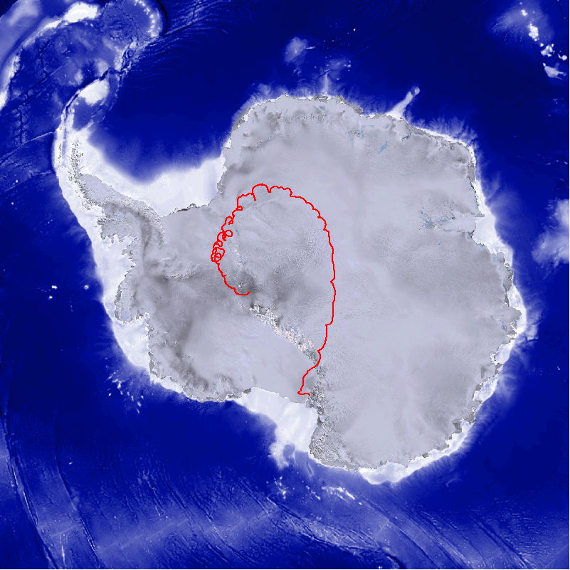
Columbia Scientific Balloon Facility
HiCAL 1 - Flight 762N - LDB Relayed Real Time GPS Data
Payload position as of:
19:23:30Z 01/13/26
Latitude: 83°36.58 S
Longitude: 174°40.21 W
Altitude: 120 Feet
0.00 Knots @ 0.00°
Full Size Payload Track Image
Google Maps
Press SHIFT and RELOAD to refresh data